Chiang Rai: The east side story
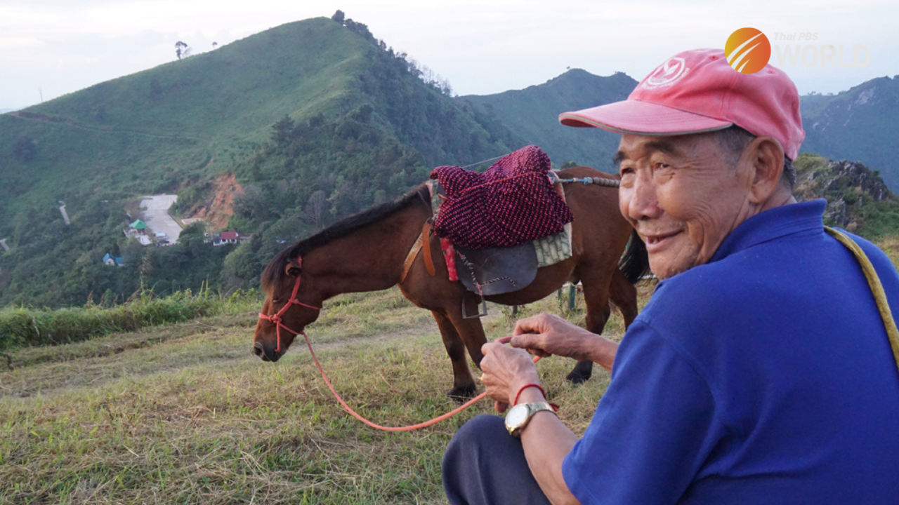
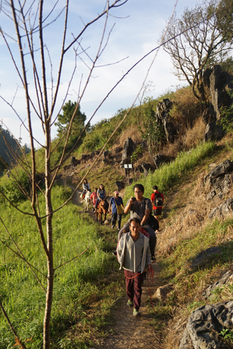
Locals offers a ride on horseback to the top of Doi Pha Tang. (Photo by Phoowadon Duangmee)
In late October, the Meteorological Department officially declared the arrival of winter in Thailand, and the change of season has thrust Chiang Rai, Thailand’s northernmost province, into the travel spotlight. While crowds gather around Chiang Rai’s north to visit the Doi Tung Palace and Mae Fah Luang Garden the cross-border market and the Golden Triangle, you can follow the great Mekong River to Chiang Rai’s east for something pure and timeless.
In the east, where the Mekong River twists its way along the Thai and Lao borders, the three little-known districts of Chiang Khong, Wiang Kaen, and Thoeng promise a much-needed escape for road-trippers and holidaymakers.
The drive east on route 1290 from the Golden Triangle in Chiang Saen district takes you past mountain scenery and river views. This section of the Mekong River is tranquil and restful. On the Thai side of the river, there are small patches of farmland, corn fields, and rice paddies, whereas the Lao side is much more desolate. Lao slow boats can be spotted making their way up and down the river from time to time. Continuing along the route, you’ll pass several small farming communities, the most interesting one of which is Saeng Arun Farm – or Rai Saeng Arun in Thai.
Nestled along a bend in the Mekong River, Saeng Arun is the finest farm stay in Chiang Khong district. It has a lodge made of reclaimed wood with a nice terrace to enjoy scenic views of the Mekong River and rolling hills. With the Mekong River at one side of your door and rice paddies on the other, Saeng Arun Farm is the place to marvel at nature, to walk and to think. All the food is homemade from its own produce, making it a great stop for a lunch break. The slow pace of life, good food and great view almost make you want to move to this part of Thailand.
The Mekong River bends sharply at Saeng Arun Farm before sweeping south to Chiang Khong, where the Mekong River bridge connects to Huay Xai in Laos. Chiang Khong, a small riverine border town, was once popular among backpackers passing through on their way to or from Laos. However, since the bridge’s opening, Chiang Khong has become a sleepy town. Fewer people want to spend a night here.
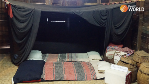
A short ride on Route 1020 from Chiang Khong town takes you to the Lue Laikham Museum. Located at Ban Sri Donchai, a large Thai Lue community, the museum is a private collection of Tai Lue traditional costumes and culture. The first floor is dedicated to the journey of the ethnic Tai Lue from Laos to Thailand, while the second floor displays a large collection of traditional clothing.
“We, the Tai Lue of Sri Donchai, moved from Yot Uo township in northern Laos before crossing the Mekong River to begin a new life in Thailand,” says Saowaluk Wongchai of Lue Laikham Museum. “Like every Tai Lue community, we make our own clothes. Weaving is our tradition, and it tells a lot about life of Tai Lue.”
Not only is clothing on show, but the museum also has a large collection of household items made of fabric. You’ll be fascinated by the various pieces of shirt and turbans, but it’s the black mosquito net that will make you raise your eyebrows. The Tai Lue seems to have a unique sense of fashion when it comes to a mosquito net. Why black?
“In Tai Lue’s extended family, everyone lives in the same home without having a private bedroom,” says Saowaluk. “A black mosquito net will conceal what’s going on inside. Our little secret will remain a secret thanks to the black mosquito net.”
The mighty Mekong River twists its way from Chiang Khong to Wiang Kaen before leaving Thailand at Pha Dai and flowing into Laos. A little out of the way, Pha Dai is known for its rocks and rapids in the middle of the Mekong. It’s also a popular Mekong fishing spot. Pha Dai is worth a detour to see where the road ends and bid farewell to the Mekong River.
In Wiang Kaen, the landscape has changed dramatically. Plains and valleys give way to towering mountains, and strawberries, table grapes, plums, and apricots take the place of corn and more corn. The hilly district is home to hill tribes and Chinese descendants, and it draws visitors for its enchanting scenery and tranquil atmosphere.
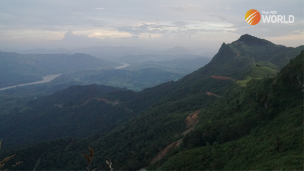
An easy 30-minute hike from a car park takes you to the cliff-top of Doi Pha Tang. Here, the mountain scenery is incomparable – especially during the sunset. Pha Tang edges out other terrific lookout spots, with panoramic views of the Thailand-Laos border. The Mekong River, too, can be seen from the cliff top, as the mighty river winds its way to Luang Phrabang and beyond.
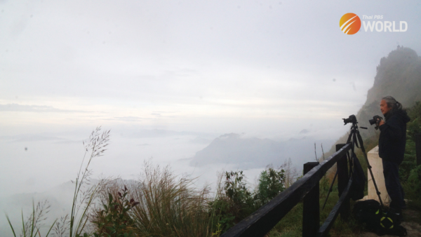
If the breathtaking sunset you’ll see from the top of Doi Pha Tang’s cliff isn’t quite enough for your winter travels, get up early to watch the spectacular sunrise at Phu Chi Dao, which is located 15 kilometres to the south of the mountain. The mountain ridge appears to surge up into the sky from its height of 1,800 meters. In the morning, the valley is covered in fluffy mist that is pierced by the outcrops of the mountains. Find your favorite spot and let the natural light show of Mother Nature inspire you.